Selection of daytrip tours that include beautiful scenery and untouched natural surroundings - Africa Natural Tours ( africanaturaltours.com )
Selection of daytrip tours that include beautiful
scenery and untouched natural surroundings: Africa Natural Tours (For
Kilimanjaro, Serengeti and Zanzibar) Tanzania safari company in Moshi
Specialized
in: Wildlife safaris, Mountain climbing,
Cultural tourism and Beach holidays in East Africa
Contact +255 653 679 958
Email:
info@africanaturaltours.com
Website: www.africanaturaltours.com

Selection
of daytrip tours that include beautiful scenery and untouched natural
surroundings
In the middle of desert area
lies the beautiful mineral spring, known locally as ‘Chemka ’meaning boiling or
bubbling in Kiswahili. Located 40km from Moshi, these tranquil springs with
crystal clear, turquoise water are surrounded by huge fig trees which are often
inhabited by (mischievous) monkeys swinging from the branches. Situated
about 35 kilometers from Moshi, in the heart of the Sanya Plains, lay the
Rundugai Springs. They are an extraordinary phenomenon, rushing up from
underground in the middle of parched and dusty landscape. Locally called
Chemka, meaning boiling, this refers to the way in which the water appears to
boil as it emerges from underground. In fact, the water is not hot rather it is
a pleasant temperature! This is a good place to visit for a picnic and a swim
too. And the views of Kilimanjaro on a clear day are also fabulous.
Unfortunately, the water is full of fluoride which means the local people can’t
use it for drinking. The crystal-clear, turquoise waters surrounded by
palm trees and winding roots offer a picturesque spot for a relaxing afternoon
swim.
The spring is actually rather
big and over 6 meters deep in some places although you can see the bottom
through the crystal clear waters no matter where you are. You can also wrap
your arms around one of the roots and just let the water flow by as you drift
off into a daydream listening to the monkeys and birds in the treas.
The
backdrop to this secluded spring is the Blue Mountains in the southeast (where
Tanzanite is mined) and Mount Kilimanjaro in the southwest, offering
spectacular views. This is an ideal location for those looking for a place to
relax, have a swim and enjoy Tanzania’s magnificent nature. Your guide and
driver will accompany you to Chemka, where a picnic or BBQ lunch will be
provided. This excursion is perfect for a full day or afternoon out, or to set
up camp for an overnight stay.
Materuni
Village is nestled in the slopes of Mount Kilimanjaro, just 30 minutes from
Moshi. Home to the Chagga tribe, the village offers everything from
breath-taking scenery, beautiful fauna and flora and an insight into the local
culture and traditions.
This
innovative and long standing tribe produces a wealth of crops ranging from
bananas, yams and sugar to maize and beans. However, Arabica coffee is the Chagga
primary cash crop and has been since colonial times.
Once
at Materuni village you will be given a tour of a family run Kahawa Shamba
(coffee farm), where you will learn about the intricacies of growing the
coffee, picking the beans, removing the cover, roasting and crushing and
finally tasting your very own cup of delicious coffee.
You
will then take a short hike to the waterfalls through the beautiful rainforest,
over small streams leading to local irrigation systems and, if it’s a clear
day, have views of Mt. Kilimanjaro. The hike will give you the chance to speak
with the locals and an opportunity to learn about the infrastructure of local
housing. The waterfalls are an impressive 150m high, originating from Kilimanjaro
glaciers, and surrounded by awesome views and birdlife. Here you can take a
refreshing dip in the cool water and enjoy a picnic lunch
For
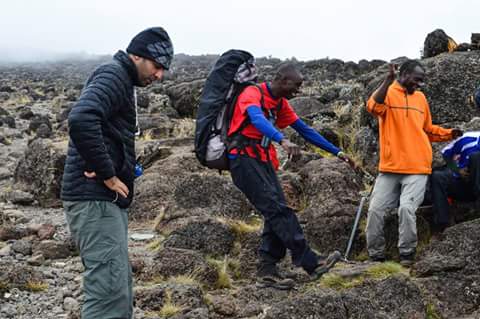
those who don’t have the desire or the time to climb to the summit of Mt.
Kilimanjaro, a day hike will give you the opportunity to experience a small but
spectacular piece of this awe-inspiring mountain. You will follow the Marangu
route, also known as the ‘Coca Cola’ route. Starting at the Marangu gate,
1,860m above sea level, your hike begins to ascend through dense forest along a
small stream.
A
3-4 hour hike will take you to Mandara Hut, 2,700m from the base of the mountain.
From here you can enjoy a short walk to the rim of Maundi Crater (a remnant of
a volcanic vent) which offers glorious views of Moshi town on a clear day and
Kibo and Mawenzi peaks. You will have time to take in this natural wonder,
whilst having a picnic lunch before descending back to the Marangu gate.
A
40 minute drive from Moshi town, located in the beautiful country side of
Marangu surrounded by lush landscapes, lays this hidden waterfall. At the base
of Mt. Kilimanjaro, Ndoro Waterfall is one of the most popular and largest
waterfalls in the area. A one hour hike, descending through the stunning green
landscapes of Chagga (the largest tribe in Tanzania) land will bring you to
this huge waterfall, here you will have the opportunity to swim in the
refreshing water and have a well-deserved break for lunch in the beautiful
valley.
You
will have the opportunity to visit a local iron monger who continues to use
traditional methods to prepare spears and tools and even see the carpenter at
work. Whilst in the area, you will also have the chance to visit an old Chagga
village and traditional Chagga house, here you can learn about the culture of
this indigenous tribe.
This
magnificent caldera lake is the ideal location to get away from it all and
immerse you in true African wilderness, whether it is for a day or overnight.
Located in the east of Kilimanjaro close to the border of Kenya, it is thought
to be the deepest inland body of water in Africa. The area has abundant
birdlife and a variety of wildlife including the dik-dik, elephants, kudu,
monkeys and baboons and offers stunning views of Mt. Kilimanjaro.
Perfect
for hiking; either down to the lake, short river walks or if you’re feeling
very adventurous you can hike around the rim of the lake, crossing into Kenya
and back again. For those just looking for tranquility and relaxation, take the
short hike down to the lake where you can have a leisurely swim, read a book
and enjoy the serenity of your surroundings. If you’re spending the day you can
either have a picnic or BBQ lunch in the afternoon or if you’d like to spend
the night we will set up camp, and enjoy a BBQ dinner around the campfire. This
truly is an excursion you just cannot miss, an opportunity to get back to
nature.
Ol Doinyo Lengai, "Mountain of God" in the Maasai language, is an active volcano located in the Gregory Rift, south of Lake Natron within the Arusha Region of Tanzania. Part of the volcanic system of the East African Rift, it uniquely produces natrocarbonatite lava. The 1960 eruption of Ol Doinyo Lengai led to geological
investigations that finally confirmed the view that carbonatite rock is derived from magma
Geology
Ol
Doinyo Lengai is unique among active volcanoes in that it produces
natrocarbonatite lava, a unique occurrence of volcanic carbonatite. A few older extinct carbonatite volcanoes are located
nearby, including Homa Mountain.
Lava
Whereas
most lava is rich in silicate minerals, the lava of Ol Doinyo Lengai
is a carbonatite. It is rich in the rare sodium and potassium carbonates, nyerereite and gregoryite. Due to this unusual composition, the lava erupts at
relatively low temperatures of approximately 510 °C (950 °F). This
temperature is so low that the molten lava appears black in sunlight, rather
than having the red glow common to most lava. It is also much more fluid than
silicate lavas, often less viscous than water. The sodium and potassium
carbonate minerals of the lavas erupted at Ol Doinyo Lengai are unstable at the
Earth's surface and susceptible to rapid weathering, quickly turning from black to grey in color. The resulting
volcanic landscape is different from any other in the world.
Ecology
The
carbonatite ash spread over the surrounding grasslands leads to a uniquely
succulent, enriched pasture. This makes the area a vital stage on the annual wildebeest beast migration, where it becomes the nursery for the birth
of several thousand calves.
Eruptive activity
1883-1915: The record of eruptions on the
mountain dates to 1883. Flows were recorded between
1904 and 1910 and between
1913 and 1915.
1917: A major eruption in June 1917
deposited volcanic ash up to 48 kilometers (30 mi) away.
1926: An eruption took place for several
months in 1926.
1940: An eruption between July and
December 1940 deposited ash as far as Loliondo, 100 kilometers (62 mi) away.
1950s: Several minor eruptions of lava were
observed in 1954, 1955, and 1958.
1960s: Minor eruptions of lava were
observed in the early 1960s.
A
major eruption occurred on 14 August 1966. Geologists J. B. Dawson and G. C.
Clark visited the crater a week later and reported seeing "a thick column
of black ash" that rose for approximately three thousand feet above the
volcano and drifted away northwards towards Lake Natron. When they climbed the
cone-shaped vent, they reported seeing a continuous discharge of gas and
whitish-grey ash and dust from the centre of the pit.
2007: Volcanic activity in the mountain
caused daily earth tremors in Kenya and Tanzania from 12 July
2007 until 18 July 2007 at 8.30pm in Nairobi. The strongest tremor measured 6.0 on the Richter scale. Geologists suspected that the
sudden increase of tremors was indicative of the movement of magma through the
Ol Doinyo Lengai. The volcano erupted on 4 September 2007, sending a plume of ash and steam at least 18 kilometers (11 mi) downwind and covering
the north and west flanks in fresh lava flows.
2008: The 2007 eruption continued
intermittently into 2008. At the end of February it was reported to be
gathering strength, with a major outburst taking place on 5 March. Periods of
inactivity were followed by eruptions on 8 and 17 April. Eruptive activity
continued until late August 2008. A visit to the summit in September 2008
discovered that lava emission had resumed from two vents in the floor of the
new crater. Visits to the crater in March/April 2009 showed that this activity
appeared to have ceased.
2010: In October 2010, two separate lava
flows and a small lava lake were photographed in an over flight.
2013: The volcano resumed natrocarbonatite
lava flow which started to fill the large crater from the 2007-2008 eruption.
As of July 2013, there is a large active hornito on the western edge of the crater floor. During June,
residents near the volcano reported several earthquakes. The new crater is
inaccessible and climbers have only occasionally glimpsed into it.

For
more information visit www.africanaturaltours.com

Comments
Post a Comment